Cyclone Nivar Puducherry update
LATEST: November 26: 4 PM
Pondicherry received more than 30 cm of rain in 24 hours (Nov 25 8.30 am- 7.30 am Nov 26)
No loss of life reported. Trees uprooted near White Town, ECR , Kamaraj Nagar etc already being cleared in many areas. We still dont have a final count. A few areas in Lawspet and Reddiarpalayam yet to get power back.
Areas like Rainbow Nagar, Venkata Nagar, Indira Gandhi Square, Krishna Nagar were waterlogged. Water is already receding in these areas or will be pumped out.
Very Severe Cyclonic storm Nivar is now weakened as a cyclonic storm & expected to weaken to a depression in the next 12 hours as it moves north-west on Tamil Nadu. The weather is clearing and section 144 has been repealed
Thank you for staying with us on the coverage! Photos, updates on cyclone coverage continue on twitter, instagram and Facebook stories. Rolling updates and info here :
GET FULL Cyclone Nivar UPDATES HERE
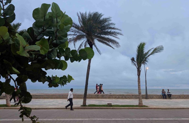
#Puducherry beach#CycloneNivar #CycloneAlert
Updates on Pondylive. com
Video: AURA Shoppe pic.twitter.com/ejxOcGYBuh— PondyLive Puducherry Updates (@pondy_live) November 24, 2020
Puducherry imposes section 144 in view of #CycloneNivar. Movement in public places is prohibited from 9 pm on November 24 to 6 am on November 26 (subject to revision based on conditions of cyclone crossing). All shops and establishments to be closed. Exceptions: Petrol pumps, pharmacies, milk booths, health services, govt officials/ agencies on cyclone duty and law and order.
RAINFALL WARNING:
November 24- 26: Widespread heavy to very heavy rainfall in parts of Puducherry and Tamil Nadu
November 25- 27: Extremely heavy rainfall in isolated parts of Tamil Nadu and Puducherry
IMPORTANT UPDATES:
- Holiday declared for educational institutes and government offices on November 25 & November 26; to compensate they will work on December 12 & 19 (Saturday). Not applicable to government officials on cyclone duty, disaster management etc
- 3 National Disaster Response Force (NDRF) teams are pre positioned in Puducherry at likely affected areas with reliable wireless & satellite communications, tree/ pole cutters for post landfall restoration and currently spreading awareness among local communities@NDRFHQ
- Industries, commercial establishments , shops, schools asked to remain shut from November 24 evening to November 25 in view of the cyclone crossing to ensure safety of students/ employees : CM
- All government departments will work round-the-clock; control rooms, rescue teams kept ready.
- In case of power interruption, it will be restored within 12 hours
- Indian Coast Guard has deployed 8 ships and 2 aircraft at sea for warning merchant ships and fishing boats on inclement weather. 23 ICG Disaster Response teams ready.
Partial train cancellation :
Train No.02898 Bhubaneswar-Puducherry special partially cancelled between Chennai Egmore- Puducherry on Nov. 24.
Train No.02897 Puducherry- Bhubaneswar is partially cancelled between Puducherry -Chennai Egmore on Nov. 25.
Train No.02868 Puducherry-Howrah Superfast special is partially cancelled between Puducherry-Villupuram on Nov 25.
FACT CHECK:
- No scheduled major power cut on Tuesday as being passed around in some WhatsApp forwards. Power disruption is possible before cyclone crossing when wind speed crosses 70 kmph. Power will be restored after the crossing, the government has said.
Note from the Editor: There are already false whatsapp forwards about the cyclone spreading through the city. You can follow our updates or any trusted news media source (papers, websites, TV channels) . Please do not share misinformation that may create panic.
Cyclone Nivar Puducherry Updates : Pondylive.com
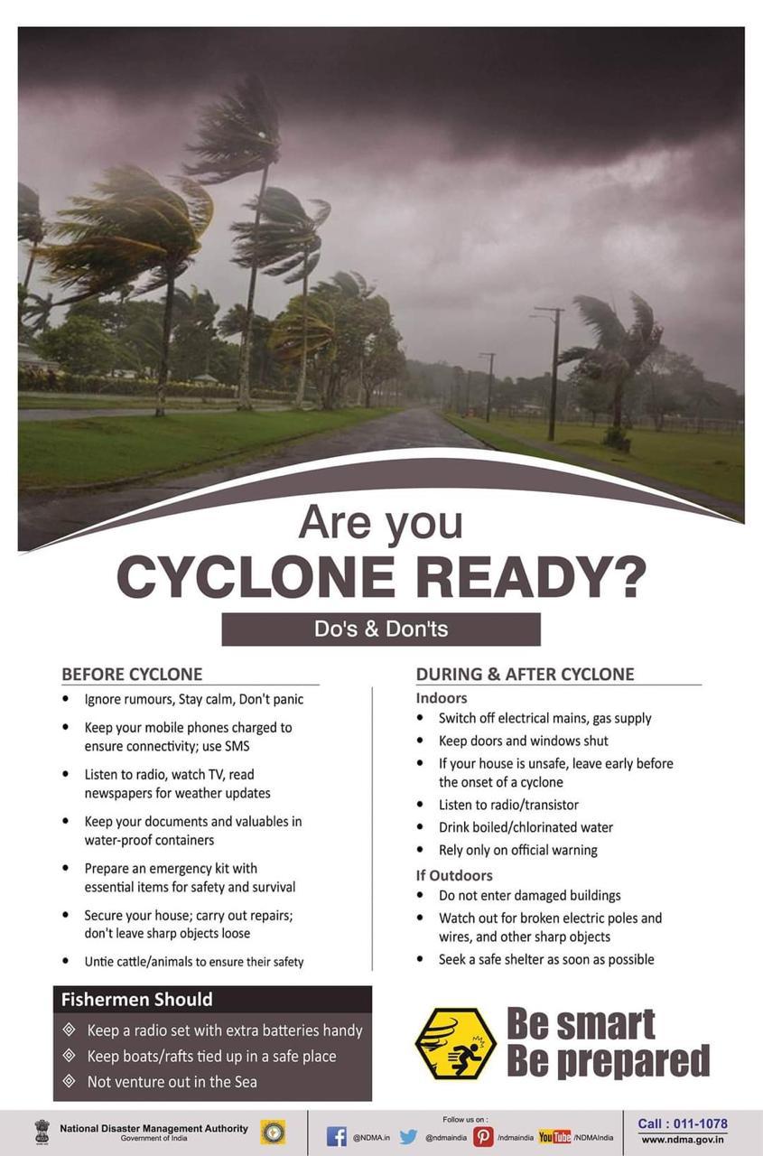
TIPS TO STAY SAFE/ PREPARED
 NDMAtI
TIMELINE
NOVEMBER 24:
4 pm: Cyclone to cross Tamilnadu-Puducherry coasts between Karaikal and Mamallapuram as a very severe cyclonic storm with wind speed of 12-130 kmph gusting to 140 kmph during late evening of 25th November.
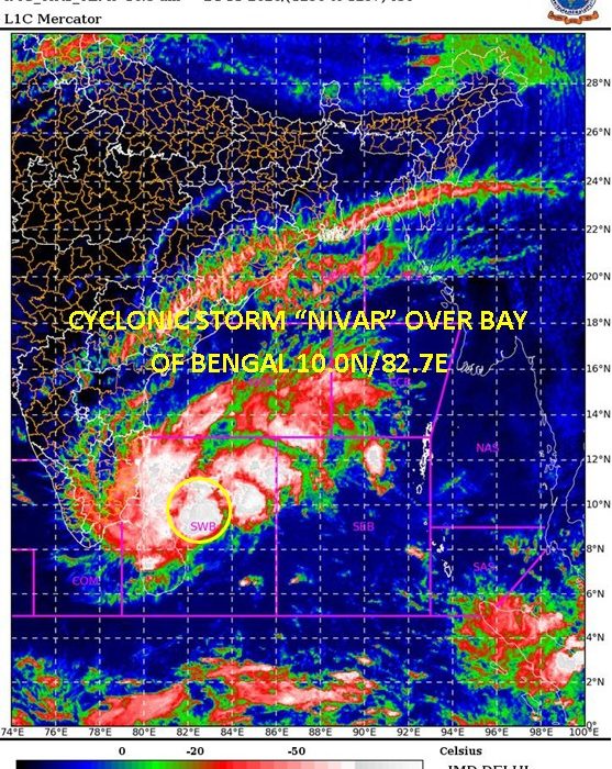
8.30 am: Deep depression over southwest Bay of Bengal intensifies into Cyclone Nivar and lies now at 430 km east-south-east of Puducherry. Very likely to intensify into severe cyclonic storm in the next 24 hours.
4 am: Deep depression over southwest Bay of Bengal. Cyclone alert (yellow) for TN & Puducherry
NOVEMBER 23:
- A depression in the Bay of Bengal 550 km off the coast of Pondicherry. Very likely to intensify into a cyclonic storm and cross Tamil Nadu / Puducherry coast between Mahabalipuram and Karaikal as SEVERE CYCLONIC STORM on November 25 : IMD
- Depression intensified into a Deep Depression over southwest Bay of Bengal (Cyclone Alert for Tamilnadu and Puducherry coasts- Yellow Message)
#CycloneNivar https://t.co/x0OVCz12Ys
— PondyLive Puducherry Updates (@pondy_live) November 23, 2020
NOVEMBER 22:
- Low pressure area becomes well marked low pressure area and likely to intensify into a cyclonic storm, move north west and cross Tamil Nadu and Puducherry coasts between Karaikal and Mahabalipuram around 25 November noon/afternoon : IMD
- Fishermen advised not to venture into sea between November 22- 25.
NOVEMBER 21:
- Indian Meterological Department (IMD) says low pressure area has formed over South Bay of Bengal; it will intensify into depression and move towards Sri Lanka and South Tami Nadu coast.
OCTOBER 28:
- North East monsoon rains commence
For instant updates, queries etc visit Pondylive’s social media handles here:
FIND COVID-19 PUDUCHERRY UPDATES HERE
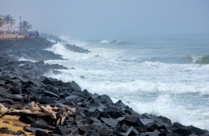
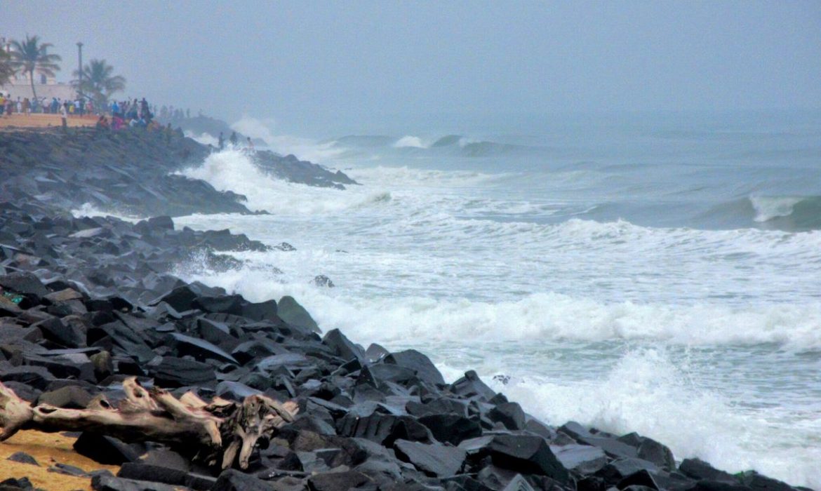
PHOTO: HARI P